
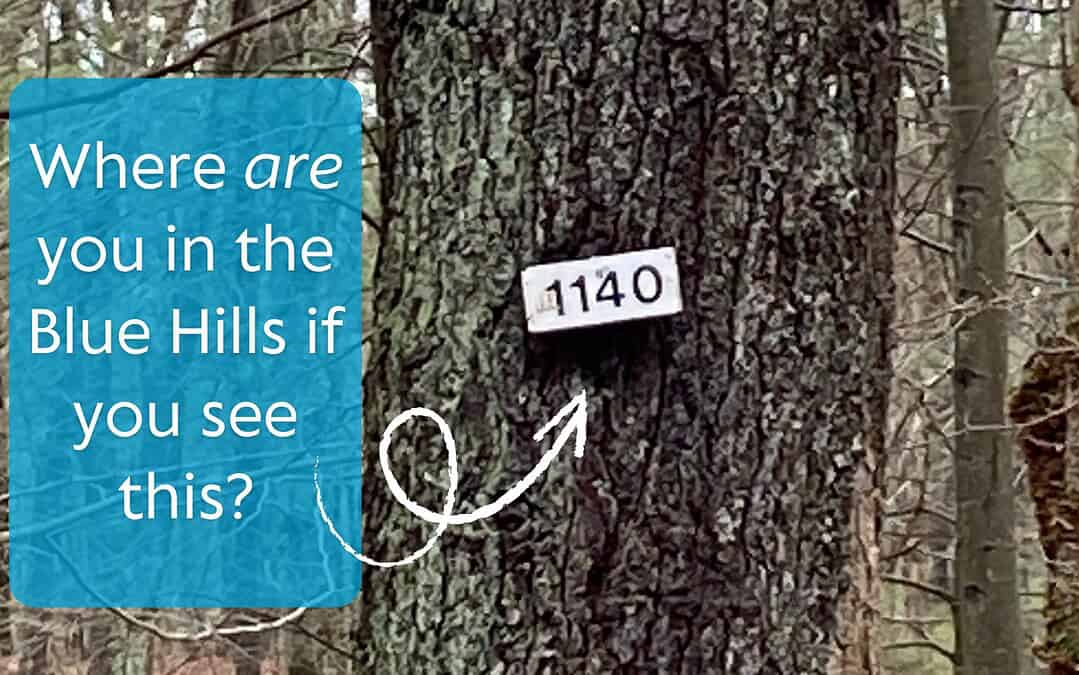
Have you ever been moving along a trail in the Blue Hills Reservation and wondered how to interpret those white wooden signs posted on select trees where trails intersect? Well, wonder no more!
They’re part of a clever navigation system designed to make exploring easier and safer.
The Department of Conservation and Recreation (DCR) uses a numbered trail intersection system to help you identify your exact location on the trail map, regardless of the path you took to get where you are.
How It Works
The Blue Hills trail network is divided into six main sections, each with its own identifying number range. The first digit of any trail marker tells you which section you’re in:
| Section Numbers | Section Name | Section Notes |
| 1xxx | Great Blue Hill | Home of the highest peak in the park (635 feet) and Blue Hill Observatory & Science Center |
| 2xxx | Houghton’s Pond | Popular for swimming, picnicking, and family hikes with plenty of parking |
| 3xxx | Chickatawbut | Scenic overlooks and great views of Boston |
| 4xxx | Quincy | Home to the Quincy Quarries on the eastern side of the reservation |
| 5xxx | Ponkapoag | Boardwalks and bogs with beautiful wetlands and the horsebridge over Route 24 to farms in Randolph |
| 6xxx | Fowl Meadow | Western section with flat, peaceful paths through high grasses |
Following the Numbers
The numbers don’t just tell you where you are — they also give you a sense of direction.
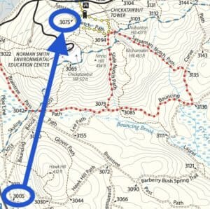
As you travel north or east, the trail numbers increase. For example, if you start at marker 3005 in the Chickatawbut Section (near Route 28 and I-93) and hike toward Chickatawbut Overlook, you’ll eventually see marker 3075 — meaning you’ve moved northeast through the section.
You’re able to tell which direction you’re heading in, even without a GPS device or smartphone.
Why Knowing Your Numbers Matters
The Blue Hills network covers more than 125 miles of trails, so having a consistent and easy-to-understand system is essential. The numbering system:
- Keeps hikers safe and oriented
- Makes it easier for volunteers and rangers to maintain trails
- Helps emergency responders locate people quickly if needed
- Encourages visitors to explore new parts of the reservation confidently
Next Time You Head to the Hills…
Before you leave home, download or print the official Blue Hills trail map here. Or, become an FBH member and get a printed map as part of your welcome packet.
Each numbered marker on the trails matches the numbers on the map, making it easy to plan routes, find connecting paths, or identify your location if you ever need help.
Take a look at those little numbered signs — they’re not just markers; they’re part of the Blue Hills story.
Answer to the question at the top of the page: The intersection of Hemenway Hill Path and Five Corners Path in the Great Blue Hill section of the park.